
The Nature Pavilion
(Comporium Communications Trail Access)
459 Colonial Drive
- Free public parking at the Lancaster High School football visitor lot
- Access to boardwalk, asphalt, and natural path segments of the Greenway
- Public restroom facilities
- Trail kiosk with map and park rules
- Benches, trash cans, doggie waste stations
- The Environmental Education Area: 12 interpretive panels, constructed wetlands & pier overlooks, pollinator gardens, public art, and a 0.3 mile natural path loop with overlooks of Gills Creek.
Barr Street Trailhead
(Founders Federal Credit Union Trail Access)
610 E. Meeting Street
- Public parking behind Barr Street Learning Center
- Access to the trail, including a beautiful tree canopy
- Public restroom facilities
- Covered bike rack
- Trail kiosk with map and park rules
- Benches, trash cans, doggie waste stations
- A family-friendly rest area, which includes: a Little Free Library, Paws on Parade arts sculpture, and a Track Trails kids nature brochure kiosk.
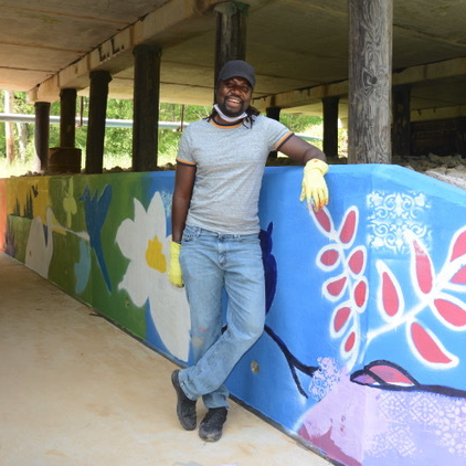
Public Art on the Greenway
Permanent art installations are unfolding through a beautiful partnership with the Lancaster County Council of the Arts. All public art on the Greenway points visitors towards our mutual mission of highlighting the beauty of our natural resources here in our local region. Find public art installations commissioned by the LCCA at the Woodland Drive tunnel underpass (by muralist Amiri Farris), the Gillsbrook Drive tunnel underpass (by muralist Alex Osborn), the Main Street mural (designed by Victor Bokas and painted by Kimsoeuth Veth and Natalie Woods), artfully painted raised manhole covers near the Nature Pavilion, a Pollinator Garden monument trellis, and two Paws on Parade sculptures by the Barr Street Trailhead.
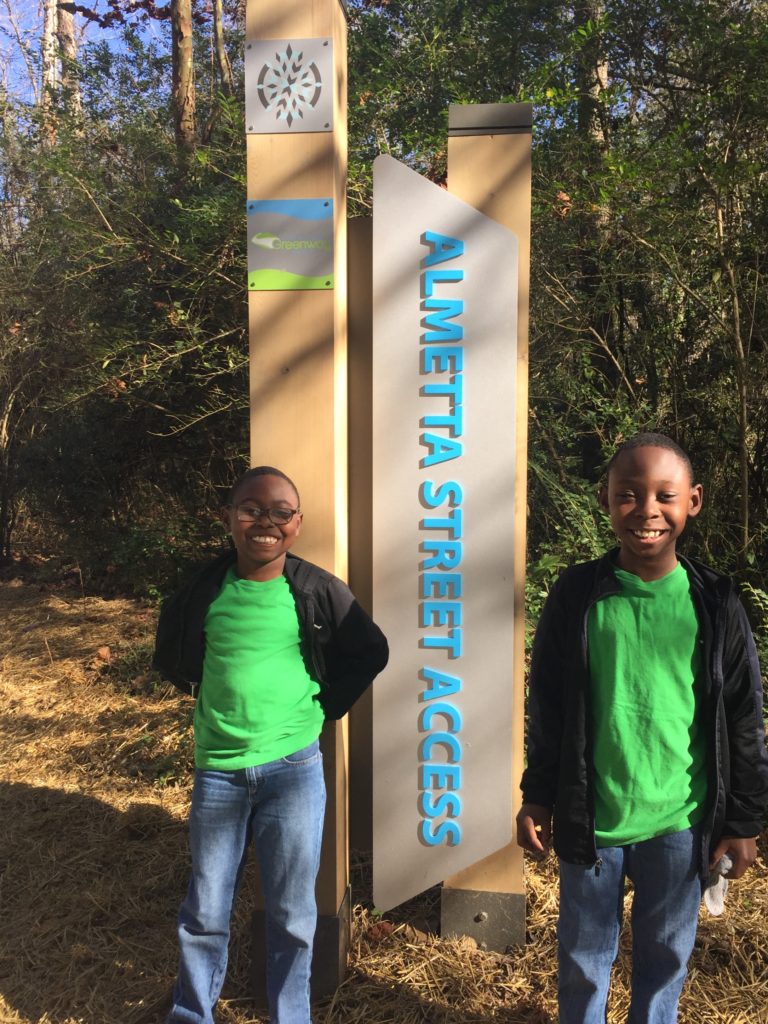
Neighborhood & Downtown Access Points
Neighborhood access points are designed to connect residents to local businesses, schools, and downtown via the trail system. They do not feature public parking.
- Survey Street
- Almetta Street
- Clinton Avenue
- Independence Park
- Sunny Hills (parking only for MUSC employees and patients, not Greenway users)
- Forest Drive (only two parking spaces, restricted for ADA only)

Accessible for All Abilities
The Greenway was intentionally designed as a hard-surface trail to ensure that people of all mobility levels can smoothly access the trail. By doing so, everyone can connect to places of interest and engage with nature. The Greenway's hard-surface route has a combination of asphalt, concrete, and boardwalk.

Connectivity
The Lindsay Pettus Greenway connects people to places, including: downtown Lancaster, four nearby schools (North Elementary, Clinton Elementary, Lancaster High, and Barr Street Learning Center), as well as many neighborhoods, local businesses, and MUSC Lancaster Medical Center.
Future phases of the Greenway will connect to USC Lancaster, Springdale Recreation Center, and the Lancaster County Health Department.
Historical Land Acknowledgement
South Carolina was home to over 25 Indigenous communities. In our area and along the Lindsay Pettus Greenway, we are on the traditional lands of the Catawbas. Today, the Catawba Nation is the only federally recognized tribe in South Carolina. Learn more by visiting the Native American Studies Center in downtown Lancaster. It's less than a one-mile walk from the Greenway.
- GREEN: The existing Lindsay Pettus Greenway, stretching from Barr Street to Gillsbrook Drive.
- BROWN: Lancaster High School's cross country trail near the LHS Visitor Lot.
- RED: Next priority projects
- BLUE: Planned future trail segments
Donate securely online now!
We're a 100% volunteer-led organization with unprecedented private/public collaboration. We focus our fundraising efforts to expand and enhance the Greenway. Donations are tax-deductible as allowed. Donate securely online through PayPal or mail checks to: Lindsay Pettus Greenway, PO Box 76, Lancaster SC 29721.